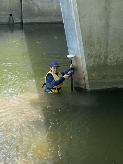
The Upper Thames River Conservation Authority is well underway with floodplain surveyors doing watercourse work.
Every year a team of field survey assistants join the conservation authority from June to November to collect information on the shape of watercourses across the Upper Thames River watershed.
While waterbodies look flat from above, the ground beneath can be far from it.
“It’s hard to tell where the ground is,” said Collin Branton, GIS Specialist – Water Resources. “So, the Surveyors use GPS equipment to measure the elevation of the ground under the water.”
Surveyors use high accuracy GPS units connected to a satellite receiver to collect elevation data.
The team also measures elevation of bridges and culverts to determine the size of the bridge opening.
With this information Water Information Management Staff can develop an understanding of how much water can flow below the bridge or culvert before it floods above it.


